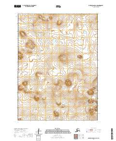
2020 Map of Nunivak Island A-4 SW
USGS Topo · Published 2020About this map
The Mekoryuk River flows across the northern reaches of this remote terrain on Nunivak Island, illustrating the drainage patterns that define the island's interior. This survey by the U.S. Geological Survey shows a landscape dominated by winding waterways and subtle elevation changes, including the Chakwakamiut River in the west and the Binajaksuit River to the south. The grid of the Public Land Survey System, specifically t1s r100w and t1s r99w, provides a structured reference over the undeveloped topography, which lacks any marked settlements or road infrastructure. The map serves as a primary record of the island's hydrography and land divisions within the Bethel Census Area.
Find a feature on this map
7 named features on this map. Tap any name to fly to it.
Don’t see what you’re looking for? This feature index may not catch every label — zoom into the map to look around manually.
Map Details
Editions of this 2020 Nunivak Island A-4 SW Map
This is the sole edition of this map. No revisions or reprints were ever made.
Other maps of this area

1951 · Cape Mendenhall
USGS Topo · 1:250,000

1951 · Nunivak Island
USGS Topo · 1:250,000

1952 · Cape Mendenhall D-4
USGS Topo · 1:63,360

1952 · Nunivak Island A-4
USGS Topo · 1:63,360

1952 · Cape Mendenhall
USGS Topo · 1:250,000

1952 · Nunivak Island A-5
USGS Topo · 1:63,360
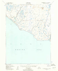
1952 · Cape Mendenhall D-5
USGS Topo · 1:63,360

1954 · Nunivak Island
USGS Topo · 1:250,000

1958 · Nunivak Island
USGS Topo · 1:250,000

1964 · Nunivak Island
USGS Topo · 1:250,000