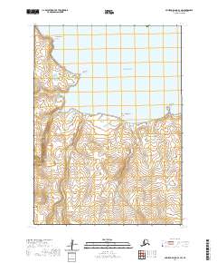
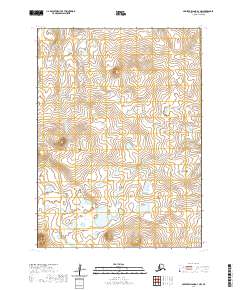
2020 Map of Nunivak Island B-3 SW
USGS Topo · Published 2020About this map
Kangnaksnak Point and Jingeeruk Point anchor the northern coastline of this maritime landscape on Nunivak Island. The shoreline is defined by several prominent landforms including Lakeekathirimjingia Point and Kookjilik Point, which reach into the Bering Sea. The interior geography is shaped by drainages such as Dakgekalik Cr and Vakeekalik Cr flowing through a coastal plain marked by numerous small ponds and wetlands. To the south, the Kuweejoongak River meanders toward the coast, illustrating the complex hydrography of this subarctic environment. The lack of built infrastructure reflects the remote nature of this portion of the Bethel Census Area, where traditional Yup'ik place names preserve the cultural geography of the island's coastline and waterways.
Find a feature on this map
12 named features on this map. Tap any name to fly to it.
Don’t see what you’re looking for? This feature index may not catch every label — zoom into the map to look around manually.
Map Details
Editions of this 2020 Nunivak Island B-3 SW Map
This is the sole edition of this map. No revisions or reprints were ever made.
Other maps of this area

1951 · Nunivak Island
USGS Topo · 1:250,000

1952 · Nunivak Island A-4
USGS Topo · 1:63,360

1952 · Nunivak Island A-3
USGS Topo · 1:63,360
1952 · Nunivak Island B-3
USGS Topo · 1:63,360
1952 · Nunivak Island B-4
USGS Topo · 1:63,360

1954 · Nunivak Island
USGS Topo · 1:250,000

1958 · Nunivak Island
USGS Topo · 1:250,000

1964 · Nunivak Island
USGS Topo · 1:250,000
2020 · Nunivak Island B-3 SE
USGS Topo · 1:25,000
2020 · Nunivak Island A-3 NW
USGS Topo · 1:25,000