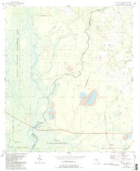
1955 Map of Nutall Rise
USGS Topo · Published 1993About this map
The Aucilla River and Wacissa River converge in this low-lying coastal plain, defining a landscape where water and timber extraction shaped early development. This mid-century survey shows the remnants of industrial activity through several stretches of Old Railroad Grade that once connected remote timber camps and landings. Small settlements like Cabbage Grove and Scanlon serve as the primary human outposts, while the namesake Nutall Rise marks a significant hydrologic feature where the river emerges from its subterranean path. Much of the western and southern reaches are preserved within the Aucilla Wildlife Management Area and St Marks National Wildlife Refuge, protecting a complex network of creeks such as Cow Creek and Page Creek. The abundance of Borrow Pits and the presence of a Lookout Tower near Cabbage Grove reflect the era's focus on resource management and fire prevention in the Florida panhandle.
Find a feature on this map
21 named features on this map. Tap any name to fly to it.
Don’t see what you’re looking for? This feature index may not catch every label — zoom into the map to look around manually.
Map Details
Editions of this 1955 Nutall Rise Map
3 editions found
Other maps of this area

1954 · Johnson Hammock
USGS Topo · 1:24,000

1954 · Cody
USGS Topo · 1:24,000

1954 · St. Marks NE
USGS Topo · 1:24,000

1954 · Cobb Rocks
USGS Topo · 1:24,000

1954 · Valdosta
USGS Topo · 1:250,000

1954 · Tallahassee
USGS Topo · 1:250,000

1955 · Snipe Island
USGS Topo · 1:24,000

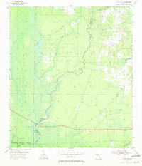
1955 · Nutall Rise
USGS Topo · 1:24,000

1955 · Lamont SE
USGS Topo · 1:24,000

1955 · Manlin Hammock
USGS Topo · 1:24,000