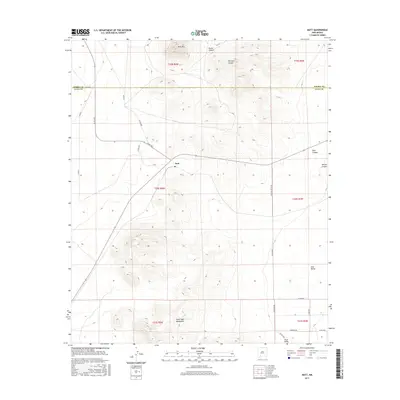
2017 Map of Nutt
USGS Topo · Published 2017About this map
Nutt serves as the focal point of this high-desert landscape in Luna County, situated at a major junction of local routes. The terrain is defined by dramatic elevation shifts, from the prominent Nutt Mtn in the north to the northern reaches of the Good Sight Mountains in the south. These volcanic features overlook the broad Uvas Valley, where seasonal drainage has carved a network of arroyos including Blue Canyon, Willow Canyon, and Duran Canyon. The map reveals a transition between the rugged heights and the valley floor, connected by a grid of county roads like Uvas Valley Rd NE and Co 27. This 2017 survey details the intersection of modern ranching infrastructure with the traditional landscape of the Sierra and Luna County borderlands.
Find a feature on this map
26 named features on this map. Tap any name to fly to it.
Don’t see what you’re looking for? This feature index may not catch every label — zoom into the map to look around manually.
Map Details
Editions of this 2017 Nutt Map
This is the sole edition of this map. No revisions or reprints were ever made.
Other maps of this area

1899 · Deming
USGS Topo · 1:125,000

1915 · Deming
USGS Topo · 1:125,000

1955 · Las Cruces
USGS Topo · 1:250,000

1958 · Las Cruces
USGS Topo · 1:250,000

1958 · Arroyo Cuervo
USGS Topo · 1:24,000

1961 · Nutt
USGS Topo · 1:62,500

1962 · Lake Valley
USGS Topo · 1:62,500

1964 · Florida
USGS Topo · 1:24,000

1972 · Good Sight Peak NE
USGS Topo · 1:24,000

1972 · Good Sight Peak
USGS Topo · 1:24,000