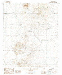
1989 Map of Nutt
USGS Topo · Published 1989About this map
Nutt stands as a focal point in this high-desert landscape, situated where the Old Railroad Grade meets a series of utility corridors and transmission lines. This late-twentieth-century study of the borderlands between Luna and Sierra Counties reveals a topography dominated by the volcanic forms of the Good Sight Mountains and the prominent Nutt Mountain to the north. The drainage patterns here are distinct, with Macho Creek and numerous steep-walled cuts like Blue Canyon and Willow Canyon defining the descent toward the expansive Uvas Valley. The presence of an isolated Landing Strip and several check dams reflects the region's adaptation to an arid climate, while the lingering trace of the railroad grade provides a tangible link to the area's older transportation history as it transitioned toward modern energy infrastructure.
Find a feature on this map
14 named features on this map. Tap any name to fly to it.
Don’t see what you’re looking for? This feature index may not catch every label — zoom into the map to look around manually.
Map Details
Editions of this 1989 Nutt Map
This is the sole edition of this map. No revisions or reprints were ever made.
Other maps of this area

1899 · Deming
USGS Topo · 1:125,000

1915 · Deming
USGS Topo · 1:125,000

1955 · Las Cruces
USGS Topo · 1:250,000

1958 · Las Cruces
USGS Topo · 1:250,000

1958 · Arroyo Cuervo
USGS Topo · 1:24,000

1961 · Nutt
USGS Topo · 1:62,500

1962 · Lake Valley
USGS Topo · 1:62,500

1964 · Florida
USGS Topo · 1:24,000

1972 · Good Sight Peak NE
USGS Topo · 1:24,000

1972 · Good Sight Peak
USGS Topo · 1:24,000