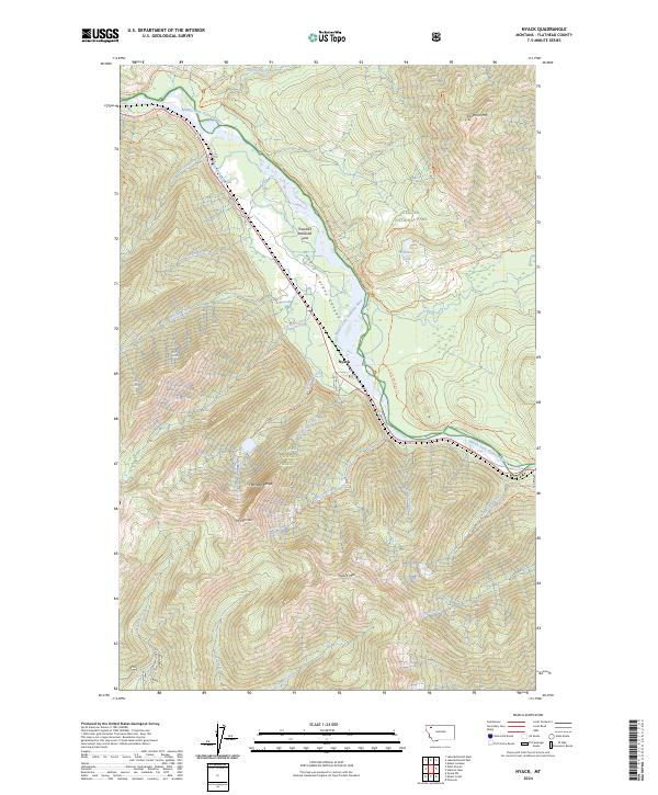
2024 Map of Nyack
USGS Topo · Published 2024About this map
The settlement of Nyack sits at a critical junction within the Middle Fork Flathead River corridor, where the Flathead Wild and Scenic River carves a deep path through the mountains. This landscape is a meeting point of major protected lands, with Glacier National Park to the north and the Great Bear Wilderness and Flathead National Forest to the south. The terrain is dominated by the massive peaks of the Flathead Range, including Mt Penrose and Nyack Mtn, while Loneman Mtn stands sentry over the northern reaches of the quadrangle.
Find a feature on this map
42 named features on this map. Tap any name to fly to it.
Don’t see what you’re looking for? This feature index may not catch every label — zoom into the map to look around manually.
Map Details
Editions of this 2024 Nyack Map
This is the sole edition of this map. No revisions or reprints were ever made.
Other maps of this area

1904 · Chief Mountain
USGS Topo · 1:125,000

1914 · Nyack
USGS Topo · 1:125,000

1938 · Chief Mountain
USGS Topo · 1:125,000

1960 · Cut Bank
USGS Topo · 1:250,000

1963 · Cut Bank
USGS Topo · 1:250,000

1964 · Cut Bank
USGS Topo · 1:250,000

1964 · Nyack
USGS Topo · 1:24,000

1964 · Pinnacle
USGS Topo · 1:24,000

1964 · Stanton Lake
USGS Topo · 1:24,000
1964 · Nyack SW
USGS Topo · 1:24,000