
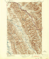
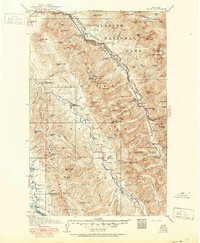
1914 Map of Nyack
USGS Topo · Published 1914About this map
The Middle Fork Flathead River serves as the primary corridor for the Great Northern railroad as it cuts through the mountains of northwestern Montana. This 1914 survey documents the wilderness interface where Glacier National Park meets the Flathead National Forest. Small settlements and railway stops like Nyack, Paola, and Essex are clustered along the river valley, providing rare points of human habitation in a landscape dominated by massive peaks and glacial features.
Find a feature on this map
143 named features on this map. Tap any name to fly to it.
Don’t see what you’re looking for? This feature index may not catch every label — zoom into the map to look around manually.
Map Details
Editions of this 1914 Nyack Map
3 editions found
Other maps of this area

1901 · Browning
USGS Topo · 1:125,000

1903 · Browning
USGS Topo · 1:125,000

1904 · Chief Mountain
USGS Topo · 1:125,000

1906 · Kintla Lakes
USGS Topo · 1:125,000

1913 · Marias Pass
USGS Topo · 1:125,000

1920 · Flathead Lake
USGS Topo · 1:125,000

1936 · Silvertip
USGS Topo · 1:96,000

1938 · Chief Mountain
USGS Topo · 1:125,000

1938 · Kintla Lakes
USGS Topo · 1:125,000

1942 · Silvertip
USGS Topo · 1:125,000