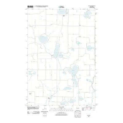
2010 Map of Nye
USGS Topo · Published 2010About this map
The Apple River corridor and a dense cluster of glacial lakes define this Polk County landscape. Small rural communities such as Nye, Ubet, and the settlement of Horse Creek are connected by a grid of county roads and avenues, including County Hwy-MM and 90th Ave. The terrain is shaped by water, with large bodies like Big Lake, Church Pine Lake, and Lotus Lake surrounded by smaller features such as Round Lake and Duck Lake. Local heritage is anchored by sites like Sand Lake Cemetery and El Salem Cemetery, reflecting the area's established residential history. In the southwest, the Saint Croix Valley Airport stands as a modern transportation landmark amid a patchwork of wetlands and creeks, including Behning Creek and Rice Creek, which feed into the larger hydrological system. The map illustrates a transitional rural character, where traditional lakeside living meets contemporary local infrastructure.
Find a feature on this map
57 named features on this map. Tap any name to fly to it.
Don’t see what you’re looking for? This feature index may not catch every label — zoom into the map to look around manually.
Map Details
Editions of this 2010 Nye Map
This is the sole edition of this map. No revisions or reprints were ever made.
Other maps of this area

1900 · St Croix Dalles
USGS Topo · 1:62,500

1901 · St Croix Dalles
USGS Topo · 1:62,500

1948 · New Richmond
USGS Topo · 1:62,500

1949 · New Richmond
USGS Topo · 1:62,500

1950 · Deer Park
USGS Topo · 1:62,500

1950 · Balsam Lake
USGS Topo · 1:62,500

1953 · Stillwater
USGS Topo · 1:250,000

1955 · St. Croix Dalles
USGS Topo · 1:62,500

1955 · Stillwater
USGS Topo · 1:250,000

1958 · Stillwater
USGS Topo · 1:250,000