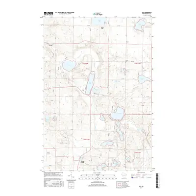
2015 Map of Nye
USGS Topo · Published 2015About this map
Dresser and the small hamlet of Nye anchor this portion of Polk County, where the landscape is defined by an intricate network of glacial lakes and creek systems. The geography is dominated by a chain of water bodies including Big Lake, Wind Lake, and Church Pine Lake in the south, while the northern reaches are home to Sand Lake and Bear Lake. These waters are linked by drainages like Horse Creek and Behling Creek, which historically supported the region's agricultural development.
Find a feature on this map
86 named features on this map. Tap any name to fly to it.
Don’t see what you’re looking for? This feature index may not catch every label — zoom into the map to look around manually.
Map Details
Editions of this 2015 Nye Map
This is the sole edition of this map. No revisions or reprints were ever made.
Other maps of this area

1900 · St Croix Dalles
USGS Topo · 1:62,500

1901 · St Croix Dalles
USGS Topo · 1:62,500

1948 · New Richmond
USGS Topo · 1:62,500

1949 · New Richmond
USGS Topo · 1:62,500

1950 · Deer Park
USGS Topo · 1:62,500

1950 · Balsam Lake
USGS Topo · 1:62,500

1953 · Stillwater
USGS Topo · 1:250,000

1955 · St. Croix Dalles
USGS Topo · 1:62,500

1955 · Stillwater
USGS Topo · 1:250,000

1958 · Stillwater
USGS Topo · 1:250,000