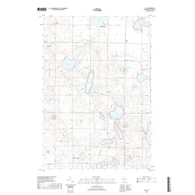
2018 Map of Nye
USGS Topo · Published 2018About this map
Glacial topography and a dense network of lakes define the landscape near the communities of Dresser and Nye. This area of Polk County is characterized by numerous small basins and wetlands, including Little Horseshoe Lake and Lotus Lake, connected by drainages like Behning Cr and Rice Cr. The settlement pattern follows a grid of county highways and local roads, such as Co Hwy M, which link smaller hamlets like Ubet and Horse Creek. For local historians and genealogists, the map identifies specific points of interest including Sand Lake Cem and El Salem Cem. The southwestern corner of the quadrangle highlights the St Croix Valley Airport, showing the intersection of rural agriculture and modern infrastructure. The eastern boundary is marked by the course of the Apple River, which serves as a major hydrological feature for the surrounding lake systems.
Find a feature on this map
46 named features on this map. Tap any name to fly to it.
Don’t see what you’re looking for? This feature index may not catch every label — zoom into the map to look around manually.
Map Details
Editions of this 2018 Nye Map
This is the sole edition of this map. No revisions or reprints were ever made.
Other maps of this area

1900 · St Croix Dalles
USGS Topo · 1:62,500

1901 · St Croix Dalles
USGS Topo · 1:62,500

1948 · New Richmond
USGS Topo · 1:62,500

1949 · New Richmond
USGS Topo · 1:62,500

1950 · Deer Park
USGS Topo · 1:62,500

1950 · Balsam Lake
USGS Topo · 1:62,500

1953 · Stillwater
USGS Topo · 1:250,000

1955 · St. Croix Dalles
USGS Topo · 1:62,500

1955 · Stillwater
USGS Topo · 1:250,000

1958 · Stillwater
USGS Topo · 1:250,000