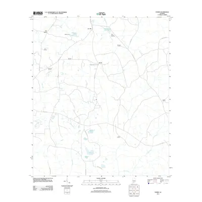
2011 Map of Nymph
USGS Topo · Published 2011About this map
Old Sparta and the namesake settlement of Nymph anchor this rural landscape in Conecuh County, Alabama. The area is defined by a dense network of country roads and numerous small family and community burial grounds, including the Sparta Cemetery, Sparta Hill Cemetery, and Greater Nazarene Cemetery. This 2011 survey reveals an environment shaped by water management, with several named ponds and dams such as McMillan Dam and Old Country Club Dam punctuating the terrain. The hydrology of the region is further characterized by the paths of Sandy Creek, Mill Creek, and Shipps Creek, which flow through the forested and agricultural tracts. Local place names like Jay Villa and Davison Cemetery provide essential markers for genealogists and local historians tracing the long-standing land divisions and community hubs of this part of southern Alabama.
Find a feature on this map
35 named features on this map. Tap any name to fly to it.
Don’t see what you’re looking for? This feature index may not catch every label — zoom into the map to look around manually.
Map Details
Editions of this 2011 Nymph Map
This is the sole edition of this map. No revisions or reprints were ever made.
Other maps of this area

1953 · Andalusia
USGS Topo · 1:250,000

1957 · Andalusia
USGS Topo · 1:250,000

1960 · Brewton North
USGS Topo · 1:24,000

1971 · Castleberry
USGS Topo · 1:24,000

1971 · Belleville
USGS Topo · 1:24,000

1982 · Shipps Creek
USGS Topo · 1:24,000

1982 · Evergreen
USGS Topo · 1:24,000

1982 · Damascus
USGS Topo · 1:24,000

1982 · Nymph
USGS Topo · 1:24,000

1982 · Old Town
USGS Topo · 1:24,000