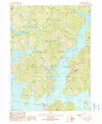
1990 Map of O'Brien
USGS Topo · Published 1990About this map
Shasta Lake dominates this 1990 survey, showing the complex interaction of the Mc Cloud River Arm, Pit River Arm, and Salt Creek Inlet. The landscape is a mix of recreational development and industrial remnants, notably the Shasta Iron Mine situated near the waters of the Pit River Arm. The settlement of O'Brien sits as a central point of land-based access, flanked by O'Brien Mountain and numerous inlets like Halfway Cove.
Find a feature on this map
54 named features on this map. Tap any name to fly to it.
Don’t see what you’re looking for? This feature index may not catch every label — zoom into the map to look around manually.
Map Details
Editions of this 1990 O'Brien Map
This is the sole edition of this map. No revisions or reprints were ever made.
Other maps of this area

1890 · Red Bluff
USGS Topo · 1:250,000

1894 · Red Bluff
USGS Topo · 1:250,000

1901 · Redding
USGS Topo · 1:125,000

1944 · Redding
USGS Topo · 1:62,500

1946 · Lamoine
USGS Topo · 1:62,500

1946 · Redding
USGS Topo · 1:62,500

1949 · Bollibokka Mtn
USGS Topo · 1:62,500

1953 · Millville
USGS Topo · 1:62,500
1956 · Shasta Dam
USGS Topo · 1:24,000
1957 · Project City
USGS Topo · 1:24,000