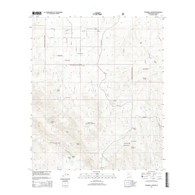
2014 Map of O'Donnell Canyon
USGS Topo · Published 2014About this map
Canelo sits at the heart of this high-elevation landscape in Santa Cruz County, where the transition from open range to the wooded slopes of the Coronado National Forest is clearly defined. The terrain is marked by a complex system of drainages, including O'Donnell Canyon, Vaughn Canyon, and Lampshire Canyon, which historically necessitated an extensive network of water management features such as Rogers Well, Frazier Tank, and Lampshire Tank. Cultural history is anchored by the Black Oak Cem and the Cemetery Tank nearby. The Arizona National Scenic Trail winds through the southern portion of the map, crossing the Canelo Hills and passing through Meadow Valley before reaching Canelo Pass. This 2014 survey documents the enduring ranching character of the region, evidenced by the numerous stock tanks and named canyons that reflect long-standing land use patterns in this part of Southern Arizona.
Find a feature on this map
70 named features on this map. Tap any name to fly to it.
Don’t see what you’re looking for? This feature index may not catch every label — zoom into the map to look around manually.
Map Details
Editions of this 2014 O'Donnell Canyon Map
This is the sole edition of this map. No revisions or reprints were ever made.
Other maps of this area

1904 · Patagonia
USGS Topo · 1:125,000

1905 · Patagonia
USGS Topo · 1:125,000

1905 · Nogales
USGS Topo · 1:125,000

1914 · Hereford
USGS Topo · 1:125,000

1915 · Benson
USGS Topo · 1:125,000

1922 · Sunnyside
USGS Topo · 1:62,500

1932 · Lochiel
USGS Topo · 1:62,500

1932 · Elgin
USGS Topo · 1:62,500

1938 · Huachuca
USGS Topo · 1:62,500

1938 · Sunnyside
USGS Topo · 1:62,500