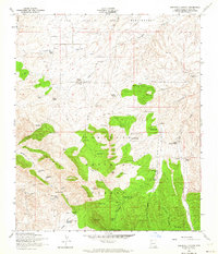
1958 Map of O'Donnell Canyon
USGS Topo · Published 1964About this map
Coronado National Forest dominates the southern landscape of this Santa Cruz County survey, where the rugged Canelo Hills provide a backdrop for a post-war ranching and mining economy. The map documents a sparsely populated but active region, centered around the settlement of Canelo and the nearby Canelo School. A network of family-held properties like Parker Ranch, Ewing Ranch, and Canelo Hills Ranch are connected by unimproved roads and jeep trails, illustrating the reliance on local water sources such as Cemetery Tank and Lampshire Well.
Find a feature on this map
68 named features on this map. Tap any name to fly to it.
Don’t see what you’re looking for? This feature index may not catch every label — zoom into the map to look around manually.
Map Details
Editions of this 1958 O'Donnell Canyon Map
3 editions found
Other maps of this area

1904 · Patagonia
USGS Topo · 1:125,000

1905 · Patagonia
USGS Topo · 1:125,000

1905 · Nogales
USGS Topo · 1:125,000

1914 · Hereford
USGS Topo · 1:125,000

1915 · Benson
USGS Topo · 1:125,000

1922 · Sunnyside
USGS Topo · 1:62,500

1932 · Lochiel
USGS Topo · 1:62,500

1932 · Elgin
USGS Topo · 1:62,500

1938 · Huachuca
USGS Topo · 1:62,500

1938 · Sunnyside
USGS Topo · 1:62,500