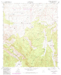
1958 Map of O'Donnell Canyon
USGS Topo · Published 1984About this map
Coronado National Forest dominates this landscape, where the rugged Canelo Hills meet a series of ranching outposts and mineral prospects. The 1958 survey, with later revisions, shows a high-desert environment defined by resource extraction and cattle operations. Mining activity is concentrated in the southwest near Redrock Canyon, evidenced by the New York Mine, La Plata Mine, and Meadow Valley Mine. These small-scale operations sit alongside long-established family landholdings like the Frazier Ranch, Houston Ranch, and Umpire Ranch.
Find a feature on this map
65 named features on this map. Tap any name to fly to it.
Don’t see what you’re looking for? This feature index may not catch every label — zoom into the map to look around manually.
Map Details
Editions of this 1958 O'Donnell Canyon Map
3 editions found
Other maps of this area

1904 · Patagonia
USGS Topo · 1:125,000

1905 · Patagonia
USGS Topo · 1:125,000

1905 · Nogales
USGS Topo · 1:125,000

1914 · Hereford
USGS Topo · 1:125,000

1915 · Benson
USGS Topo · 1:125,000

1922 · Sunnyside
USGS Topo · 1:62,500

1932 · Lochiel
USGS Topo · 1:62,500

1932 · Elgin
USGS Topo · 1:62,500

1938 · Huachuca
USGS Topo · 1:62,500

1938 · Sunnyside
USGS Topo · 1:62,500