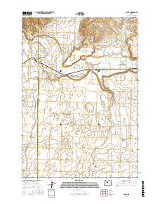
2017 Map of O'Neil
USGS Topo · Published 2017About this map
O'Neil sits at the heart of this agricultural and geologic landscape, where the Crooked River transitions into the dramatic Crooked River Gorge. The map illustrates a complex irrigation network vital to this high desert region, featuring the North Unit Main Canal and the Pilot Butte N Canal, which support the farms and ranches across Lone Pine Flat. The terrain is defined by the sharp contrast between these life-giving waterways and the naturally arid drainage of the Dry River.
Find a feature on this map
47 named features on this map. Tap any name to fly to it.
Don’t see what you’re looking for? This feature index may not catch every label — zoom into the map to look around manually.
Map Details
Editions of this 2017 O'Neil Map
This is the sole edition of this map. No revisions or reprints were ever made.
Other maps of this area

1926 · Bend
USGS Topo · 1:125,000

1929 · Bend
USGS Topo · 1:125,000

1955 · Bend
USGS Topo · 1:250,000

1957 · Bend
USGS Topo · 1:250,000

1958 · Bend
USGS Topo · 1:250,000

1961 · Redmond
USGS Topo · 1:24,000

1962 · Opal City
USGS Topo · 1:24,000

1962 · Forked Horn Butte
USGS Topo · 1:24,000

1962 · Oneil
USGS Topo · 1:24,000

1962 · Huston Lake
USGS Topo · 1:24,000