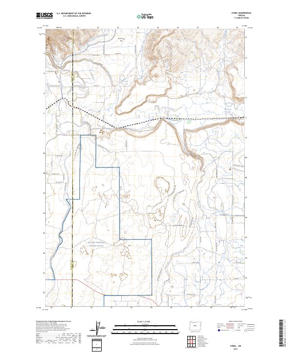
2023 Map of O'Neil
USGS Topo · Published 2023About this map
The Crooked River carves a dramatic path through this central Oregon landscape, defined by the deep incision of the Crooked River Gorge in the north and the meandering McAllister Slough to the east. Modern land use is clearly delineated by the presence of the NG Biak Training Center Coutes, which occupies a significant portion of the southern terrain. This area demonstrates a sophisticated irrigation network vital to the high desert, featuring the Pilot Butte North Canal and the North Unit Main Canal.
Find a feature on this map
45 named features on this map. Tap any name to fly to it.
Don’t see what you’re looking for? This feature index may not catch every label — zoom into the map to look around manually.
Map Details
Editions of this 2023 O'Neil Map
This is the sole edition of this map. No revisions or reprints were ever made.
Other maps of this area

1926 · Bend
USGS Topo · 1:125,000

1929 · Bend
USGS Topo · 1:125,000

1955 · Bend
USGS Topo · 1:250,000

1957 · Bend
USGS Topo · 1:250,000

1958 · Bend
USGS Topo · 1:250,000

1961 · Redmond
USGS Topo · 1:24,000

1962 · Opal City
USGS Topo · 1:24,000

1962 · Forked Horn Butte
USGS Topo · 1:24,000

1962 · Oneil
USGS Topo · 1:24,000

1962 · Huston Lake
USGS Topo · 1:24,000