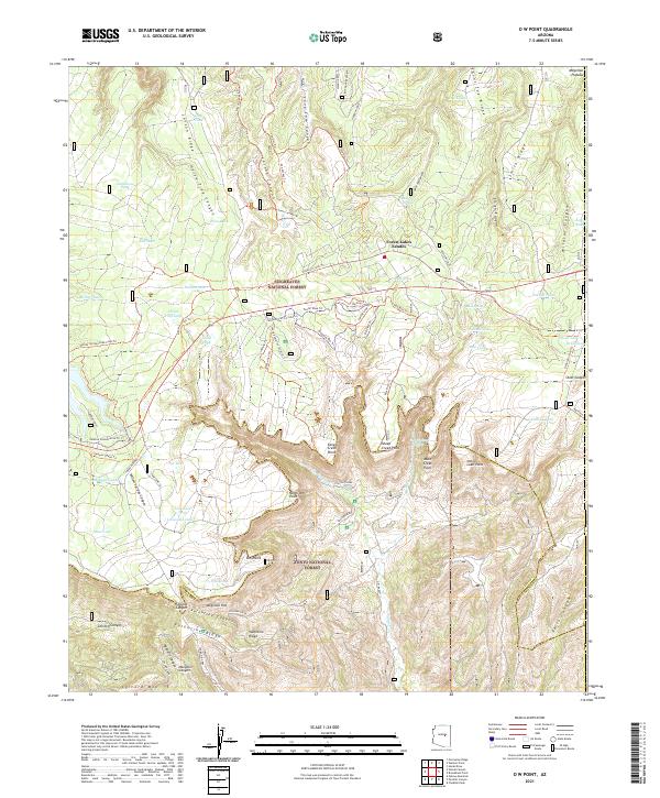
2021 Map of O W Point
USGS Topo · Published 2021About this map
The Mogollon Rim forms the dramatic centerpiece of this 2021 topographic survey, marking the transition between the high Mogollon Plateau and the deeply dissected canyons of the Tonto National Forest below. This sharp escarpment is punctuated by distinct geographical markers such as OW Point, North OW Point, and Canyon Creek Point. The plateau above is defined by a dense network of forest roads and trails, including the General Crook Trl and the Rim Road, serving the residential pocket of Forest Lakes Estates.
Find a feature on this map
79 named features on this map. Tap any name to fly to it.
Don’t see what you’re looking for? This feature index may not catch every label — zoom into the map to look around manually.
Map Details
Editions of this 2021 O W Point Map
This is the sole edition of this map. No revisions or reprints were ever made.
Other maps of this area

1886 · Holbrook
USGS Topo · 1:250,000

1893 · Holbrook
USGS Topo · 1:250,000

1954 · Holbrook
USGS Topo · 1:250,000

1957 · Holbrook
USGS Topo · 1:250,000

1958 · Holbrook
USGS Topo · 1:250,000

1960 · Holbrook
USGS Topo · 1:250,000

1961 · Woods Canyon
USGS Topo · 1:62,500

1961 · Heber
USGS Topo · 1:62,500

1961 · Chediski Peak
USGS Topo · 1:62,500
1961 · Young
USGS Topo · 1:62,500