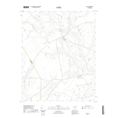
2019 Map of Oak City
USGS Topo · Published 2019About this map
Oak City and the small town of Hassell anchor this eastern North Carolina landscape, where the flat coastal plain is deeply defined by intricate wetland networks. Significant hydrologic features like Etheridge Swamp and Ross Swamp dominate the northern and southern sectors, respectively, while the waters of Conoho Cr and Crisp Cr carve low-lying paths across the terrain. The map reveals a rural economy organized around family-named farm roads and crossroads, including Mayo Farm Rd and Wilsons Store Rd. Situated along the border of Martin and Edgecombe counties, the area's development follows the higher ground between these swampy drainages. The grid of Oak City shows a concentrated residential core compared to the more linear settlement pattern of Hassell, illustrating the regional reliance on traditional road corridors like Hassell Rd and Hines Rd.
Find a feature on this map
37 named features on this map. Tap any name to fly to it.
Don’t see what you’re looking for? This feature index may not catch every label — zoom into the map to look around manually.
Map Details
Editions of this 2019 Oak City Map
This is the sole edition of this map. No revisions or reprints were ever made.
Other maps of this area

1901 · Parmele
USGS Topo · 1:62,500

1901 · Williamston
USGS Topo · 1:62,500

1902 · Williamston
USGS Topo · 1:62,500

1902 · Parmele
USGS Topo · 1:62,500

1953 · Norfolk
USGS Topo · 1:250,000

1953 · Rocky Mount
USGS Topo · 1:250,000

1954 · Rocky Mount
USGS Topo · 1:250,000

1962 · Palmyra
USGS Topo · 1:24,000

1962 · Hobgood
USGS Topo · 1:24,000

1972 · Woodville
USGS Topo · 1:24,000