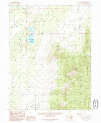
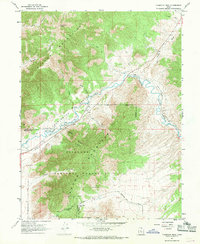
1985 Map of Oak City North
USGS Topo · Published 1985About this map
Oak City sits at the base of the mountains in Millard County, representing a classic Great Basin agricultural settlement pattern during the mid-1980s. The landscape is defined by the critical management of water, where the Central Utah Canal and the Sevier River support the valley's arid ecology. To the west, the topographic depression known as the Sinks and the Fool Creek Reservoir capture runoff from the high country.
Find a feature on this map
22 named features on this map. Tap any name to fly to it.
Don’t see what you’re looking for? This feature index may not catch every label — zoom into the map to look around manually.
Map Details
Editions of this 1985 Oak City North Map
This is the sole edition of this map. No revisions or reprints were ever made.
Other maps of this area

1885 · Sevier Desert
USGS Topo · 1:250,000
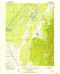
1951 · Oak City
USGS Topo · 1:62,500
1952 · Scipio North
USGS Topo · 1:62,500

1953 · Delta
USGS Topo · 1:250,000

1958 · Delta
USGS Topo · 1:250,000

1962 · Delta
USGS Topo · 1:250,000
1962 · Lynndyl
USGS Topo · 1:62,500
1967 · Champlin Peak
USGS Topo · 1:24,000
1979 · Lynndyl
USGS Topo · 1:100,000
1985 · Harding
USGS Topo · 1:24,000