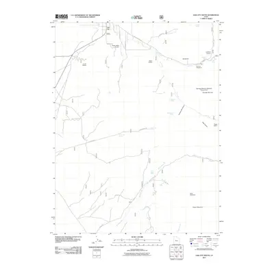
2011 Map of Oak City South
USGS Topo · Published 2011About this map
Oak City sits at the northern edge of this high-elevation landscape, where the settlement grid gives way to the rising slopes of the Canyon Mountains. In the early 21st century, this area remains defined by its complex hydrology and vertical terrain, with numerous springs such as Cascade Spring, Mayparty Spring, and Whisky Spring feeding the seasonal drainages that cut through the limestone. The transition from the valley floor into the mountains is marked by the Oak City Cemetery and the winding path of Oak Creek Canyon Rd.
Find a feature on this map
42 named features on this map. Tap any name to fly to it.
Don’t see what you’re looking for? This feature index may not catch every label — zoom into the map to look around manually.
Map Details
Editions of this 2011 Oak City South Map
This is the sole edition of this map. No revisions or reprints were ever made.
Other maps of this area

1885 · Sevier Desert
USGS Topo · 1:250,000

1951 · Oak City
USGS Topo · 1:62,500

1952 · Scipio North
USGS Topo · 1:62,500

1953 · Delta
USGS Topo · 1:250,000

1958 · Delta
USGS Topo · 1:250,000

1962 · Delta
USGS Topo · 1:250,000

1962 · Holden
USGS Topo · 1:62,500
1969 · Scipio Pass
USGS Topo · 1:24,000
1985 · Harding
USGS Topo · 1:24,000
1985 · Oak City North
USGS Topo · 1:24,000