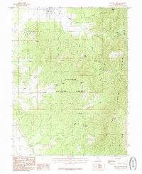
1985 Map of Oak City South
USGS Topo · Published 1985About this map
Oak City sits at the northern edge of this high-desert landscape, where the transition from the valley floor to the steep slopes of the Mountains is marked by a network of drainage systems and isolated springs. The terrain is dominated by the Fishlake National Forest, a region defined by its complex topography of canyons and ridges. Local names such as Lovell Hollow, Jack Hill, and Partridge Mountain suggest a history of family ties to the land, while the presence of a Cem and a Gravel Pit near the town center reflects the essential infrastructure of this rural community in the mid-1980s.
Find a feature on this map
44 named features on this map. Tap any name to fly to it.
Don’t see what you’re looking for? This feature index may not catch every label — zoom into the map to look around manually.
Map Details
Editions of this 1985 Oak City South Map
This is the sole edition of this map. No revisions or reprints were ever made.
Other maps of this area

1885 · Sevier Desert
USGS Topo · 1:250,000

1951 · Oak City
USGS Topo · 1:62,500

1952 · Scipio North
USGS Topo · 1:62,500

1953 · Delta
USGS Topo · 1:250,000

1958 · Delta
USGS Topo · 1:250,000

1962 · Delta
USGS Topo · 1:250,000

1962 · Holden
USGS Topo · 1:62,500
1969 · Scipio Pass
USGS Topo · 1:24,000
1985 · Harding
USGS Topo · 1:24,000
1985 · Oak City North
USGS Topo · 1:24,000