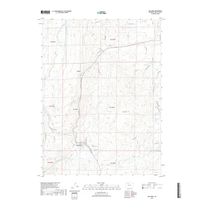
2019 Map of Oak Creek
USGS Topo · Published 2019About this map
The town of Oak Creek serves as the focal point for this Routt County landscape, where the local economy and geography are defined by a complex network of water management. Ditch systems such as the Oak-Dale Ditch, Rossi-Highline Ditch, and Korf Ditch Number 1 carve through the terrain, supporting the region's ranching and agricultural interests. To the north and west, the smaller settlements of Haybro and Keystone sit along the winding course of Oak Creek, while the prominent Thorpe Mountain rises to the east.
Find a feature on this map
63 named features on this map. Tap any name to fly to it.
Don’t see what you’re looking for? This feature index may not catch every label — zoom into the map to look around manually.
Map Details
Editions of this 2019 Oak Creek Map
This is the sole edition of this map. No revisions or reprints were ever made.
Other maps of this area

1924 · Mt. Harris
USGS Topo · 1:48,000

1926 · Mount Harris
USGS Topo · 1:62,500

1954 · Craig
USGS Topo · 1:250,000

1957 · Craig
USGS Topo · 1:250,000

1958 · Craig
USGS Topo · 1:250,000

1960 · Craig
USGS Topo · 1:250,000

1962 · Craig
USGS Topo · 1:250,000

1964 · Craig
USGS Topo · 1:250,000

1965 · Craig
USGS Topo · 1:250,000
1966 · Sand Point
USGS Topo · 1:24,000