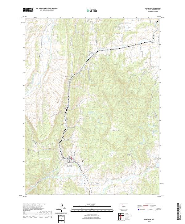
2022 Map of Oak Creek
USGS Topo · Published 2022About this map
The town of Oak Creek sits at the heart of this high-elevation landscape, where the local economy and water management are intertwined with the terrain. The map documents a sophisticated network of irrigation and storage, featuring numerous named systems like the Rossi-Highline Ditch, Oak Dale Ditch, and Cotinel Ditch that feed into landmarks such as Chambers Reservoir and Henderson Reservoir. These engineering works highlight the historical importance of water rights and agricultural sustainability in Routt County.
Find a feature on this map
65 named features on this map. Tap any name to fly to it.
Don’t see what you’re looking for? This feature index may not catch every label — zoom into the map to look around manually.
Map Details
Editions of this 2022 Oak Creek Map
This is the sole edition of this map. No revisions or reprints were ever made.
Other maps of this area

1924 · Mt. Harris
USGS Topo · 1:48,000

1926 · Mount Harris
USGS Topo · 1:62,500

1954 · Craig
USGS Topo · 1:250,000

1957 · Craig
USGS Topo · 1:250,000

1958 · Craig
USGS Topo · 1:250,000

1960 · Craig
USGS Topo · 1:250,000

1962 · Craig
USGS Topo · 1:250,000

1964 · Craig
USGS Topo · 1:250,000

1965 · Craig
USGS Topo · 1:250,000
1966 · Sand Point
USGS Topo · 1:24,000