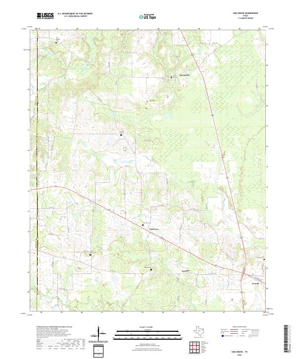
2022 Map of Oak Grove
USGS Topo · Published 2022About this map
Oak Grove and Spring Hill anchor this rural landscape in eastern Texas, where a dense network of county roads connects numerous local burial grounds. The territory is defined by its small-scale water systems, including Tanyard Cr, Mud Cr, and the slow-moving Hooks Bayou. Numerous family and community landmarks are documented throughout the township, such as Pine Springs Cem and West Bowie Cem. The southern edge of the survey transitions toward the outskirts of De Kalb, marked by the presence of De Kalb Cem. The distribution of these features across the Red River Co and Bowie Co line suggests a deeply established agricultural and residential pattern where local identity is closely tied to these small, named settlements and their associated cemeteries.
Find a feature on this map
57 named features on this map. Tap any name to fly to it.
Don’t see what you’re looking for? This feature index may not catch every label — zoom into the map to look around manually.
Map Details
Editions of this 2022 Oak Grove Map
This is the sole edition of this map. No revisions or reprints were ever made.
Other maps of this area

1930 · Bassett
USGS Topo · 1:62,500

1950 · De Kalb NW
USGS Topo · 1:24,000

1950 · Tom
USGS Topo · 1:24,000

1950 · De Kalb
USGS Topo · 1:24,000

1950 · Oak Grove
USGS Topo · 1:24,000

1951 · De Kalb
USGS Topo · 1:24,000

1951 · English
USGS Topo · 1:24,000

1951 · De Kalb NW
USGS Topo · 1:24,000

1951 · Tom
USGS Topo · 1:24,000

1951 · Oak Grove
USGS Topo · 1:24,000