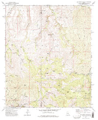
1972 Map of Oak Grove Canyon
USGS Topo · Published 1975About this map
The Galiuro Mountains dominate this 1970s landscape, where the Pinal and Graham county line cuts through deep drainages and mineral-rich ridges. This era shows an active mining history concentrated in the southern sections, notably around the Glory Hole Mine, Table Mtn Mine, and The Hendrickson Mine. These operations were served by the Copper Creek siding and a network of jeep trails connecting remote outposts like Lime Camp and Parsons Grove.
Find a feature on this map
62 named features on this map. Tap any name to fly to it.
Don’t see what you’re looking for? This feature index may not catch every label — zoom into the map to look around manually.
Map Details
Editions of this 1972 Oak Grove Canyon Map
2 editions found
Other maps of this area

1911 · Winkelman
USGS Topo · 1:125,000

1913 · Winkelman
USGS Topo · 1:125,000

1938 · Galiuro Mts
USGS Topo · 1:48,000

1938 · Klondyke
USGS Topo · 1:48,000

1943 · Galiuro Mts
USGS Topo · 1:62,500

1943 · Klondyke
USGS Topo · 1:62,500

1948 · Clark Ranch
USGS Topo · 1:24,000

1948 · Mammoth
USGS Topo · 1:62,500

1949 · Clark Ranch
USGS Topo · 1:24,000

1949 · Holy Joe Peak
USGS Topo · 1:62,500