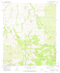
1972 Map of Oak Grove Canyon
USGS Topo · Published 1975About this map
The rugged topography of the Galiuro Mountains dominates this 1970s survey, illustrating a landscape defined by deep canyons and a legacy of mining activity. In the southwest corner, a cluster of claims marks the mining district near the Copper Creek (Site), including the Glory Hole Mine, Copper Prince Mine, and The Hendrickson Mine. These operations, along with the Table Mtn Mine to the northwest, highlight the mineral-rich character of the Graham and Pinal county border. The presence of numerous corrals, such as the Don Jose Corral and Hanks Corral, indicates the area's dual use for ranching, supported by scattered water sources like Jackson Spring and Mescal Tank. The boundary between Pinal and Graham counties bisects the quadrangle, which also encompasses a portion of the Coronado National Forest. Small settlements and camps, including Parsons Grove and Lime Camp, suggest the isolated residential patterns common to this interior Arizona range during the mid-20th century.
Find a feature on this map
72 named features on this map. Tap any name to fly to it.
Don’t see what you’re looking for? This feature index may not catch every label — zoom into the map to look around manually.
Map Details
Editions of this 1972 Oak Grove Canyon Map
2 editions found
Other maps of this area

1911 · Winkelman
USGS Topo · 1:125,000

1913 · Winkelman
USGS Topo · 1:125,000

1938 · Galiuro Mts
USGS Topo · 1:48,000

1938 · Klondyke
USGS Topo · 1:48,000

1943 · Galiuro Mts
USGS Topo · 1:62,500

1943 · Klondyke
USGS Topo · 1:62,500

1948 · Clark Ranch
USGS Topo · 1:24,000

1948 · Mammoth
USGS Topo · 1:62,500

1949 · Clark Ranch
USGS Topo · 1:24,000

1949 · Holy Joe Peak
USGS Topo · 1:62,500