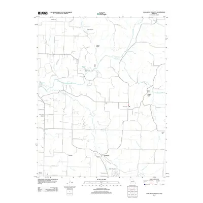
2011 Map of Oak Grove Heights
USGS Topo · Published 2011About this map
The James River snakes through the central corridor of this Greene County landscape, defining the local geography around Oak Grove Heights and the small settlements of Lon and All. The river’s path is marked by infrastructure and landmarks including the Steel Bridge and the Barnard Lake Dam. This 2011 survey captures a mix of residential expansion and preserved rural elements, where named hollows like Millan Hollow, Canyon Hollow, and White Oak Hollow cut into the terrain. For those tracing local family roots, the map provides precise locations for several burial grounds, including the Henderson Cemetery, Panther Valley Cemetery, and Wilkerson Cemetery. Significant water features such as Lake James, fed by Broad Creek, and the winding Panther Creek illustrate the watershed that supports this community just east of Springfield.
Find a feature on this map
99 named features on this map. Tap any name to fly to it.
Don’t see what you’re looking for? This feature index may not catch every label — zoom into the map to look around manually.
Map Details
Editions of this 2011 Oak Grove Heights Map
This is the sole edition of this map. No revisions or reprints were ever made.
Other maps of this area

1884 · Springfield
USGS Topo · 1:125,000

1886 · Springfield
USGS Topo · 1:125,000

1937 · Galloway
USGS Topo · 1:24,000

1937 · Ozark
USGS Topo · 1:48,000

1939 · Fordland
USGS Topo · 1:62,500

1942 · Fordland
USGS Topo · 1:62,500

1943 · Ozark
USGS Topo · 1:62,500

1945 · Ozark
USGS Topo · 1:62,500

1946 · Bassville
USGS Topo · 1:24,000

1946 · Niangua
USGS Topo · 1:62,500