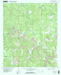
1980 Map of Oak Grove
USGS Topo · Published 1980About this map
Valley Cr snakes through the heart of this landscape, carving sharp turns at Sextons Bend and the narrow passage known as The Narrows. This region on the border of Jefferson and Tuscaloosa Counties shows a landscape transitioning between rural settlements and industrial extraction in the early 1980s. The small communities of Toadvine, Oak Grove, and Betty Hill are surrounded by an extensive network of resource extraction, with numerous areas marked as Strip Mine and the substantial Oak Grove Mine operations including a large Tailings Pond.
Find a feature on this map
39 named features on this map. Tap any name to fly to it.
Don’t see what you’re looking for? This feature index may not catch every label — zoom into the map to look around manually.
Map Details
Editions of this 1980 Oak Grove Map
2 editions found
Other maps of this area

1893 · Jasper
USGS Topo · 1:125,000

1899 · Brookwood
USGS Topo · 1:125,000

1927 · Adger
USGS Topo · 1:48,000

1929 · Searles
USGS Topo · 1:48,000

1932 · Yolande
USGS Topo · 1:62,500

1934 · Searles
USGS Topo · 1:62,500

1935 · Port Birmingham
USGS Topo · 1:48,000

1935 · Yolande
USGS Topo · 1:62,500

1938 · Port Birmingham
USGS Topo · 1:62,500

1949 · Tutwiler School
USGS Topo · 1:24,000