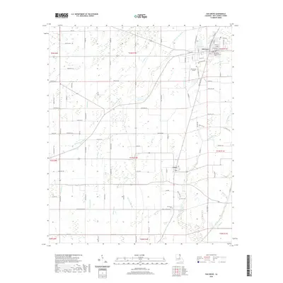
2020 Map of Oak Grove
USGS Topo · Published 2020About this map
Oak Grove serves as the focal point of this northeastern Louisiana landscape, anchored by the West Carroll Parish Courthouse and a detailed grid of local streets like E Main St and Industrial Blvd. To the south, the village of Forest marks a distinct community center surrounded by the Forest Cem and New Forest Cem. The terrain is defined by a dense network of meandering waterways that characterize the Mississippi Delta region, including the winding Little Colewa Bayou, Bell Bayou, and Big Venison Bayou. These bayous, along with others like Caney Glade Bayou and Alligator Bayou, dictate the drainage patterns across the parish. Aviation infrastructure is present at the Kelly-Dumas Airport, while the rural areas are connected by a system of section roads such as Barton Rd and Cook Rd, illustrating the transition between the developed parish seat and the surrounding agricultural bottomlands.
Find a feature on this map
99 named features on this map. Tap any name to fly to it.
Don’t see what you’re looking for? This feature index may not catch every label — zoom into the map to look around manually.
Map Details
Editions of this 2020 Oak Grove Map
This is the sole edition of this map. No revisions or reprints were ever made.
Other maps of this area

1909 · Baxter Bayou
USGS Topo · 1:24,000

1909 · Ashton Bridge
USGS Topo · 1:24,000

1911 · Baxter Bayou
USGS Topo · 1:24,000

1912 · Ashton Bridge
USGS Topo · 1:31,680

1914 · Baxter Bayou
USGS Topo · 1:31,680

1935 · Hurricane
USGS Topo · 1:62,500

1935 · Oak Grove
USGS Topo · 1:62,500

1935 · Bonita
USGS Topo · 1:62,500

1955 · Jackson
USGS Topo · 1:250,000

1958 · Oak Grove
USGS Topo · 1:62,500