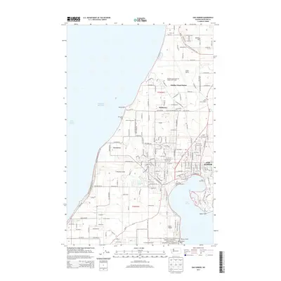
2014 Map of Oak Harbor
USGS Topo · Published 2014About this map
Oak Harbor and the surrounding reaches of Whidbey Island appear here in a period of modern growth and military importance. The northern portion of the map is dominated by the Whidbey Island Naval Air Station (Ault Field), with its network of runways and service roads like Ault Field Rd cutting through the landscape. This military footprint contrasts with established local landmarks such as Maple Leaf Cem and the residential clusters of Marketown and Clover Valley. Along the western shoreline, the terrain meets the Puget Sound and the Strait of Juan de Fuca at Rocky Point, while the southern reaches transition into the protected landscape of the Ebeys Landing National Historical Reserve. The map details a complex coastal environment where aviation infrastructure, maritime activities at the Oak Harbor Marina, and historic land conservation intersect.
Find a feature on this map
67 named features on this map. Tap any name to fly to it.
Don’t see what you’re looking for? This feature index may not catch every label — zoom into the map to look around manually.
Map Details
Editions of this 2014 Oak Harbor Map
This is the sole edition of this map. No revisions or reprints were ever made.
Other maps of this area

1939 · Port Townsend
USGS Topo · 1:62,500

1939 · Coupeville
USGS Topo · 1:62,500

1943 · Richardson
USGS Topo · 1:62,500

1943 · Deception Pass
USGS Topo · 1:62,500

1951 · Deception Pass
USGS Topo · 1:62,500

1953 · Coupeville
USGS Topo · 1:24,000

1953 · Camano
USGS Topo · 1:24,000

1953 · Port Townsend North
USGS Topo · 1:24,000

1957 · Richardson
USGS Topo · 1:62,500

1957 · Victoria
USGS Topo · 1:250,000