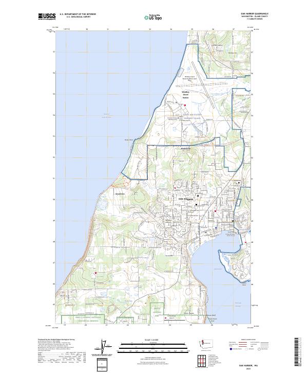
2023 Map of Oak Harbor
USGS Topo · Published 2023About this map
The northern reaches of Whidbey Island are defined by a complex intersection of military infrastructure and preservation. This modern survey illustrates the expansive footprint of the Whidbey Island Naval Air Station (Ault Field) and the associated Sea Plane Base at Oak Harbor, while the southern boundary transitions into the protected landscape of the Ebey's Landing National Historical Reserve. These two distinct land uses frame the city itself, where local history is anchored by sites like Pioneer Burial Park and Maple Leaf Cem.
Find a feature on this map
97 named features on this map. Tap any name to fly to it.
Don’t see what you’re looking for? This feature index may not catch every label — zoom into the map to look around manually.
Map Details
Editions of this 2023 Oak Harbor Map
This is the sole edition of this map. No revisions or reprints were ever made.
Other maps of this area

1939 · Port Townsend
USGS Topo · 1:62,500

1939 · Coupeville
USGS Topo · 1:62,500

1943 · Richardson
USGS Topo · 1:62,500

1943 · Deception Pass
USGS Topo · 1:62,500

1951 · Deception Pass
USGS Topo · 1:62,500

1953 · Coupeville
USGS Topo · 1:24,000

1953 · Camano
USGS Topo · 1:24,000

1953 · Port Townsend North
USGS Topo · 1:24,000

1957 · Richardson
USGS Topo · 1:62,500

1957 · Victoria
USGS Topo · 1:250,000