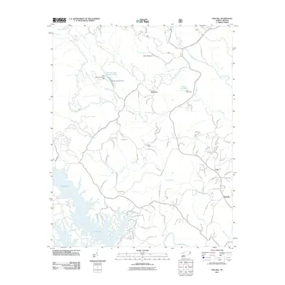
2011 Map of Oak Hill
USGS Topo · Published 2011About this map
Lake James dominates the southwestern corner of this topographic study, where the Catawba River and its various tributaries reach into the foothills of Burke County. The landscape is defined by its complex hydrology, from the intricate shoreline of the reservoir to the specialized infrastructure at the Table Rock State Fish Hatchery. This facility, supported by the Table Rock Fish Hatchery Lake and its accompanying dam, highlights the region's focus on conservation and aquatic management during this period. In the eastern reaches, the settlement of Oak Hill and the smaller community at Gold provide a contrast to the rugged elevations of Miller Mountain and the prominent landmark of Table Rock. Numerous family-named roads and rural routes like Brown Mountain Beach Rd and Pea Ridge Rd weave between the creeks, reflecting a pattern of residential growth and long-established mountain homesteads.
Find a feature on this map
107 named features on this map. Tap any name to fly to it.
Don’t see what you’re looking for? This feature index may not catch every label — zoom into the map to look around manually.
Map Details
Editions of this 2011 Oak Hill Map
This is the sole edition of this map. No revisions or reprints were ever made.
Other maps of this area

1905 · Morganton
USGS Topo · 1:125,000

1934 · Linville Falls
USGS Topo · 1:24,000

1953 · Charlotte
USGS Topo · 1:250,000

1954 · Charlotte
USGS Topo · 1:250,000

1956 · Oak Hill
USGS Topo · 1:24,000

1956 · Collettsville
USGS Topo · 1:24,000

1956 · Morganton North
USGS Topo · 1:24,000

1956 · Ashford
USGS Topo · 1:24,000
1956 · Linville Falls
USGS Topo · 1:24,000

1956 · Morganton South
USGS Topo · 1:24,000