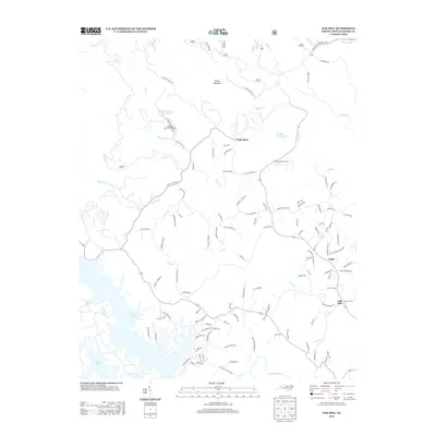
2013 Map of Oak Hill
USGS Topo · Published 2013About this map
The sprawling waters of Lake James dominate the southwestern corner of this landscape, where complex shorelines meet a dense network of mountain creeks. This Burke County terrain is defined by the Catawba River drainage and the presence of the Tablerock State Fish Hatchery, an important regional landmark located near Table Rock Fish Hatchery Lake. The settlement of Oak Hill sits to the southeast, while the small community of Gold and the peak of Miller Mountain anchor the central and northern sections of the map.
Find a feature on this map
116 named features on this map. Tap any name to fly to it.
Don’t see what you’re looking for? This feature index may not catch every label — zoom into the map to look around manually.
Map Details
Editions of this 2013 Oak Hill Map
This is the sole edition of this map. No revisions or reprints were ever made.
Other maps of this area

1905 · Morganton
USGS Topo · 1:125,000

1934 · Linville Falls
USGS Topo · 1:24,000

1953 · Charlotte
USGS Topo · 1:250,000

1954 · Charlotte
USGS Topo · 1:250,000

1956 · Oak Hill
USGS Topo · 1:24,000

1956 · Collettsville
USGS Topo · 1:24,000

1956 · Morganton North
USGS Topo · 1:24,000

1956 · Ashford
USGS Topo · 1:24,000
1956 · Linville Falls
USGS Topo · 1:24,000

1956 · Morganton South
USGS Topo · 1:24,000