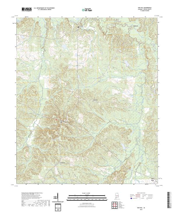
2024 Map of Oak Hill
USGS Topo · Published 2024About this map
Oak Hill and the surrounding Wilcox County countryside appear here in contemporary detail, showing a landscape defined by its small settlements and winding watercourses. The local terrain is partitioned by several drainage systems, including Pine Barren Creek to the north and the networks of Callie Creeks and Bear Creek to the south. Historically significant nodes like Allenton and Caledonia are connected by a web of rural routes such as Sheffield Rd and Wagon Wheel Rd, tracing patterns of movement that have persisted for generations. Genealogists may find the location of McConico Cem particularly notable, situated near the northern boundary. The map illustrates how the settlement at Pine Apple anchors the southeastern corner, while the scattered dwellings near McBrydes reflect the enduring agricultural character of this portion of Alabama.
Find a feature on this map
25 named features on this map. Tap any name to fly to it.
Don’t see what you’re looking for? This feature index may not catch every label — zoom into the map to look around manually.
Map Details
Editions of this 2024 Oak Hill Map
This is the sole edition of this map. No revisions or reprints were ever made.
Other maps of this area

1953 · Montgomery
USGS Topo · 1:250,000

1953 · Andalusia
USGS Topo · 1:250,000

1956 · Montgomery
USGS Topo · 1:250,000

1957 · Montgomery
USGS Topo · 1:250,000

1957 · Andalusia
USGS Topo · 1:250,000

1957 · Carlowville
USGS Topo · 1:62,500

1957 · Braggs
USGS Topo · 1:62,500
1981 · Rosebud
USGS Topo · 1:24,000
1981 · Oak Hill
USGS Topo · 1:24,000

1981 · Pine Apple North
USGS Topo · 1:24,000