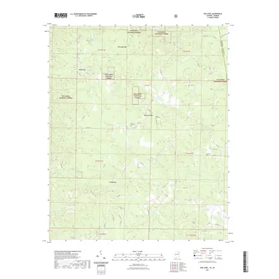
2021 Map of Oak Level
USGS Topo · Published 2021About this map
Talladega National Forest encompasses large portions of this landscape along the Alabama-Georgia border, where the headwaters of numerous creeks carve through the terrain of Cleburne County. The settlement of Edwardsville and the community at Oak Level are connected by a network of rural routes, including Co RD 49 and Co RD 283. This 2021 survey details several legacy burial grounds such as Mars Hill Cem and Mount Perry Cem, which serve as vital markers for genealogical research in these wooded uplands. The drainage patterns of Terrapin Cr and Muscadine Cr define the local topography, while the proximity to the state line near Roe Cem illustrates the trans-border connections of the rural population. Small clusters at Piney Woods and Coldwater remain centered around intersections of county roads, preserving a footprint of long-standing residential patterns within the national forest boundaries.
Find a feature on this map
69 named features on this map. Tap any name to fly to it.
Don’t see what you’re looking for? This feature index may not catch every label — zoom into the map to look around manually.
Map Details
Editions of this 2021 Oak Level Map
This is the sole edition of this map. No revisions or reprints were ever made.
Other maps of this area

1889 · Tallapoosa
USGS Topo · 1:125,000

1892 · Tallapoosa
USGS Topo · 1:125,000

1897 · Tallapoosa
USGS Topo · 1:125,000

1900 · Anniston
USGS Topo · 1:125,000

1953 · Atlanta
USGS Topo · 1:250,000

1957 · Atlanta
USGS Topo · 1:250,000

1958 · Atlanta
USGS Topo · 1:250,000

1965 · Tallapoosa South
USGS Topo · 1:24,000

1966 · Tallapoosa North
USGS Topo · 1:24,000
1966 · Benedict
USGS Topo · 1:24,000