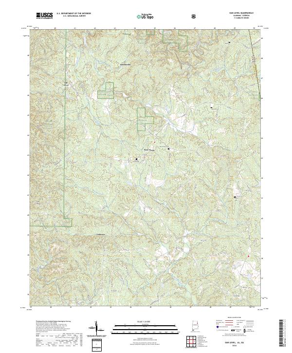
2024 Map of Oak Level
USGS Topo · Published 2024About this map
The boundary between Alabama and Georgia runs through the eastern portion of this landscape, where the Talladega National Forest covers significant acreage. Rural life in Cleburne County is centered around small settlements like Oak Level, Edwardsville, and Piney Woods, with the terrain shaped by the intricate drainage of Muscadine Creek and Terrapin Creek. The map reveals a deeply rooted community structure, evidenced by the numerous family and community burial grounds such as Cherry Grove Cem and Mars Hill Cem.
Find a feature on this map
70 named features on this map. Tap any name to fly to it.
Don’t see what you’re looking for? This feature index may not catch every label — zoom into the map to look around manually.
Map Details
Editions of this 2024 Oak Level Map
This is the sole edition of this map. No revisions or reprints were ever made.
Other maps of this area

1889 · Tallapoosa
USGS Topo · 1:125,000

1892 · Tallapoosa
USGS Topo · 1:125,000

1897 · Tallapoosa
USGS Topo · 1:125,000

1900 · Anniston
USGS Topo · 1:125,000

1953 · Atlanta
USGS Topo · 1:250,000

1957 · Atlanta
USGS Topo · 1:250,000

1958 · Atlanta
USGS Topo · 1:250,000

1965 · Tallapoosa South
USGS Topo · 1:24,000

1966 · Tallapoosa North
USGS Topo · 1:24,000
1966 · Benedict
USGS Topo · 1:24,000