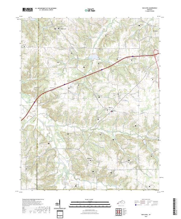
2022 Map of Oak Level
USGS Topo · Published 2022About this map
Oak Level and Brewers anchor this portion of western Kentucky, where the landscape is defined by the winding tributaries of the West Fork Clarks River. This survey captures a rural territory densely populated with family cemeteries and historic country churches, suggesting a long-established community structure. Notable landmarks such as Potato Hill and Waller Hill rise above the numerous creek branches, including Soldier Cr and Middle Fork Cr, which historically dictated the placement of early homesteads and roads.
Find a feature on this map
136 named features on this map. Tap any name to fly to it.
Don’t see what you’re looking for? This feature index may not catch every label — zoom into the map to look around manually.
Map Details
Editions of this 2022 Oak Level Map
This is the sole edition of this map. No revisions or reprints were ever made.
Other maps of this area

1936 · Farmington
USGS Topo · 1:24,000

1936 · Oak Level
USGS Topo · 1:24,000

1936 · Elva
USGS Topo · 1:24,000

1936 · Hardin
USGS Topo · 1:24,000

1936 · Symsonia
USGS Topo · 1:24,000

1936 · Benton
USGS Topo · 1:48,000

1936 · Westplains
USGS Topo · 1:24,000

1936 · Dexter
USGS Topo · 1:24,000

1936 · Kirksey
USGS Topo · 1:24,000
1936 · Briensburg
USGS Topo · 1:24,000