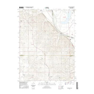
2015 Map of Oak Mills
USGS Topo · Published 2015About this map
Missouri River bluffs and floodplain deposits dominate this landscape at the intersection of Atchison and Leavenworth Counties. The terrain transitions from the alluvial bottomlands of Bean Lake and the river banks to the dissected uplands where several historic cemeteries, including Gillin Cem and Saint Patrick Cem, serve as landmarks for early family settlements. The community of Oak Mills is situated near the river, while further inland, Lowemont and Millwood anchor the rural landscape.
Find a feature on this map
81 named features on this map. Tap any name to fly to it.
Don’t see what you’re looking for? This feature index may not catch every label — zoom into the map to look around manually.
Map Details
Editions of this 2015 Oak Mills Map
This is the sole edition of this map. No revisions or reprints were ever made.
Other maps of this area

1885 · Atchison
USGS Topo · 1:125,000

1886 · Oskaloosa
USGS Topo · 1:125,000

1888 · Oskaloosa
USGS Topo · 1:125,000

1888 · Atchison
USGS Topo · 1:125,000

1890 · Kansas City
USGS Topo · 1:125,000

1893 · Atchison
USGS Topo · 1:125,000

1894 · Kansas City
USGS Topo · 1:125,000

1894 · Oskaloosa
USGS Topo · 1:125,000

1910 · Leavenworth
USGS Topo · 1:62,500

1926 · Atchison
USGS Topo · 1:62,500