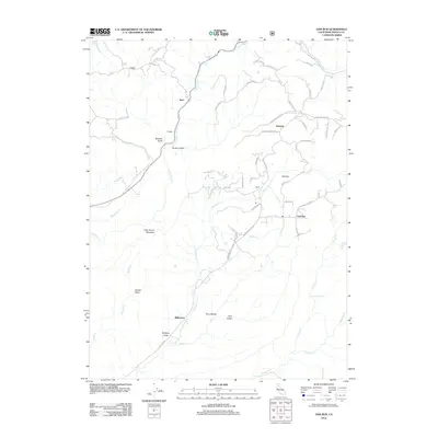
2012 Map of Oak Run
USGS Topo · Published 2012About this map
Ingot and Oak Run serve as primary hubs in this mountainous Shasta County landscape, where the terrain is defined by a dense network of watercourses and winding ridges. The topography is etched with deep drainage patterns including Little Cow Creek and Oak Run Creek, while historical routes like Old Stage Road and Donkey Mine Road hint at the area's extraction and transit history. Small settlements and named locales like Osborne, Estep, and Wilkinson are scattered among the timbered slopes, connected by a web of mountain roads such as Backbone Road and Bullskin Ridge Road. The southern portion of the sheet features prominent natural landmarks like Little Round Mountain and the scenic Clover Creek Falls, illustrating the transition from high ridgelines down into protected hollows like Price Hollow and Swede Basin.
Find a feature on this map
56 named features on this map. Tap any name to fly to it.
Don’t see what you’re looking for? This feature index may not catch every label — zoom into the map to look around manually.
Map Details
Editions of this 2012 Oak Run Map
This is the sole edition of this map. No revisions or reprints were ever made.
Other maps of this area

1886 · Lassen Peak
USGS Topo · 1:250,000

1890 · Red Bluff
USGS Topo · 1:250,000

1892 · Lassen Peak
USGS Topo · 1:250,000

1894 · Lassen Peak
USGS Topo · 1:250,000

1894 · Red Bluff
USGS Topo · 1:250,000

1901 · Redding
USGS Topo · 1:125,000

1935 · Burney
USGS Topo · 1:96,000

1939 · Burney
USGS Topo · 1:125,000

1949 · Bollibokka Mtn
USGS Topo · 1:62,500

1953 · Millville
USGS Topo · 1:62,500