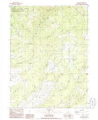
1985 Map of Oak Run
USGS Topo · Published 1986About this map
Ingot stands as a focal point of historical mining activity in this corner of Shasta County, surrounded by industrial remnants such as Ruins (Tailings) and the Coronado Mine. The landscape is a network of rugged drainages including Little Cow Creek and Norton Gulch, where smaller operations like the Dickey Mine were established. Near the center of the sheet, the Tollgate (Site) marks a key point on the old travel routes that once connected these remote mining camps to larger valley settlements.
Find a feature on this map
40 named features on this map. Tap any name to fly to it.
Don’t see what you’re looking for? This feature index may not catch every label — zoom into the map to look around manually.
Map Details
Editions of this 1985 Oak Run Map
This is the sole edition of this map. No revisions or reprints were ever made.
Other maps of this area

1886 · Lassen Peak
USGS Topo · 1:250,000

1890 · Red Bluff
USGS Topo · 1:250,000

1892 · Lassen Peak
USGS Topo · 1:250,000

1894 · Lassen Peak
USGS Topo · 1:250,000

1894 · Red Bluff
USGS Topo · 1:250,000

1901 · Redding
USGS Topo · 1:125,000

1935 · Burney
USGS Topo · 1:96,000

1939 · Burney
USGS Topo · 1:125,000

1949 · Bollibokka Mtn
USGS Topo · 1:62,500

1953 · Millville
USGS Topo · 1:62,500