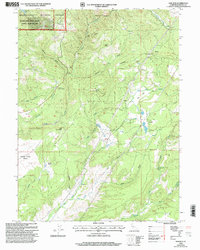
1998 Map of Oak Run
USGS Topo · Published 2003About this map
Bullskin Ridge and the Oak Run Flat define this pocket of Shasta County, where the transition from forest to plain is marked by a legacy of resource extraction. The community of Oak Run serves as a central point, while the northern reaches of the map reflect an earlier industrial era near Ingot, featuring the Coronado Mine and the Donkey Mine. These mining operations, complete with Ruins Tailings, are situated along Furnaceville Creek, hinting at the copper and silver booms that once energized this landscape. In the northwest, the boundary of the Whiskeytown-Shasta-Trinity National Recreation Area meets the Shasta-Trinity National Forests, where the Diddy Wells Forest Fire Station overlooks the descent into the Swede Creek Plains. This topography of gulches and hollows, such as Seaman Gulch and Price Hollow, illustrates a land shaped by both its drainage patterns and its heritage of settlement at places like Furnaceville and the Tollgate Site.
Find a feature on this map
41 named features on this map. Tap any name to fly to it.
Don’t see what you’re looking for? This feature index may not catch every label — zoom into the map to look around manually.
Map Details
Editions of this 1998 Oak Run Map
This is the sole edition of this map. No revisions or reprints were ever made.
Other maps of this area

1886 · Lassen Peak
USGS Topo · 1:250,000

1890 · Red Bluff
USGS Topo · 1:250,000

1892 · Lassen Peak
USGS Topo · 1:250,000

1894 · Lassen Peak
USGS Topo · 1:250,000

1894 · Red Bluff
USGS Topo · 1:250,000

1901 · Redding
USGS Topo · 1:125,000

1935 · Burney
USGS Topo · 1:96,000

1939 · Burney
USGS Topo · 1:125,000

1949 · Bollibokka Mtn
USGS Topo · 1:62,500

1953 · Millville
USGS Topo · 1:62,500