
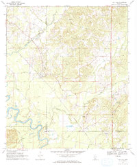
1970 Map of Oak Vale
USGS Topo · Published 1972About this map
The Pearl River meanders through the southwestern corner of this 1970 Mississippi landscape, marking a clear boundary for Marion Co. The settlement of Oak Vale serves as a central hub, situated where the Illinois Central railroad corridor crosses the terrain. This era of the region’s development is characterized by a significant extraction industry, evidenced by the numerous Gravel Pits concentrated around the White Sand Creek and Dry Creek drainages.
Find a feature on this map
28 named features on this map. Tap any name to fly to it.
Don’t see what you’re looking for? This feature index may not catch every label — zoom into the map to look around manually.
Map Details
Editions of this 1970 Oak Vale Map
2 editions found
Other maps of this area

1953 · Hattiesburg
USGS Topo · 1:250,000

1953 · Natchez
USGS Topo · 1:250,000

1956 · Natchez
USGS Topo · 1:250,000

1958 · Hattiesburg
USGS Topo · 1:250,000

1959 · Natchez
USGS Topo · 1:250,000

1970 · Prentiss West
USGS Topo · 1:24,000

1970 · Monticello
USGS Topo · 1:24,000

1970 · Bunker Hill
USGS Topo · 1:24,000

1970 · Darbun
USGS Topo · 1:24,000

1970 · Morgantown
USGS Topo · 1:24,000