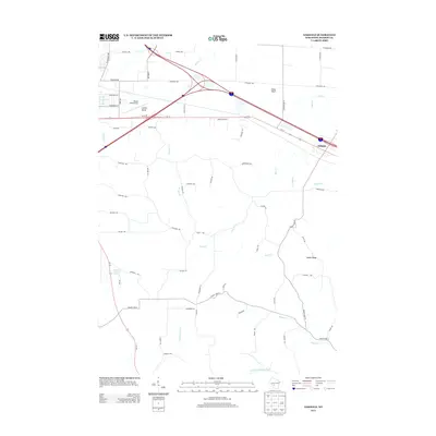
2013 Map of Oakdale
USGS Topo · Published 2013About this map
Oakdale and the surrounding Monroe County landscape are defined by a complex network of waterways and prominent glacial-relief features in this 2013 survey. The terrain is punctuated by distinctive high points such as Camels Hump, Stone Bluff, and Indian Ridge, which oversee a dense grid of rural roads and the intersection of major interstate and highway routes. Bloyer Field Airport serves as a local aviation hub just west of these highlands, while the valley floors are drained by numerous streams including Kreyer Cr, Bear Cr, and Indian Cr.
Find a feature on this map
63 named features on this map. Tap any name to fly to it.
Don’t see what you’re looking for? This feature index may not catch every label — zoom into the map to look around manually.
Map Details
Editions of this 2013 Oakdale Map
This is the sole edition of this map. No revisions or reprints were ever made.
Other maps of this area

1916 · Tomah
USGS Topo · 1:62,500

1919 · Kendall
USGS Topo · 1:62,500

1921 · Kendall
USGS Topo · 1:62,500

1947 · Millston
USGS Topo · 1:62,500

1949 · Millston
USGS Topo · 1:62,500

1949 · Tomah
USGS Topo · 1:62,500

1953 · Eau Claire
USGS Topo · 1:250,000

1958 · Eau Claire
USGS Topo · 1:250,000

1958 · Wyeville
USGS Topo · 1:48,000

1958 · La Crosse
USGS Topo · 1:250,000