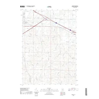
2018 Map of Oakdale
USGS Topo · Published 2018About this map
Tomah and the village of Oakdale anchor this 2018 topographic survey of Monroe County, which reveals a landscape defined by the drainage systems of the Kickapoo River and the Little Lemonweir River. The northern section is dominated by the aviation footprint of Bloyer Field and the transportation corridor where major routes intersect. Moving south, the terrain becomes increasingly complex, transitioning into a series of ridges and valleys. Distinctive natural landmarks such as Stone Bluff, Camel's Hump, and Indian Ridge rise above the surrounding creeks. Local heritage is preserved at the Oakdale Cem, while the hydrology of the region is further detailed by Council Creek Spring and the winding course of Indian Cr through Cold Spring Valley.
Find a feature on this map
51 named features on this map. Tap any name to fly to it.
Don’t see what you’re looking for? This feature index may not catch every label — zoom into the map to look around manually.
Map Details
Editions of this 2018 Oakdale Map
This is the sole edition of this map. No revisions or reprints were ever made.
Other maps of this area

1916 · Tomah
USGS Topo · 1:62,500

1919 · Kendall
USGS Topo · 1:62,500

1921 · Kendall
USGS Topo · 1:62,500

1947 · Millston
USGS Topo · 1:62,500

1949 · Millston
USGS Topo · 1:62,500

1949 · Tomah
USGS Topo · 1:62,500

1953 · Eau Claire
USGS Topo · 1:250,000

1958 · Eau Claire
USGS Topo · 1:250,000

1958 · Wyeville
USGS Topo · 1:48,000

1958 · La Crosse
USGS Topo · 1:250,000