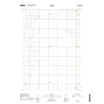
2018 Map of Oakes SE
USGS Topo · Published 2018About this map
Ludden stands in the southwestern corner of this survey, marking a small pocket of settlement amidst a vast grid of section lines and gravel roads. The western edge of the quadrangle is defined by the James River, which meanders through a landscape heavily marked by wetlands and seasonal sloughs. This particular stretch of North Dakota terrain reflects the systematic organization of the Public Land Survey System, with township lines like t130n r59w and t129n r59w providing the primary structure for the region's agricultural layout. The boundary between Dickey County and Sargent County runs vertically along the eastern edge of the map, following 114th Ave SE. A dense network of local roads, including 94th St SE and 110th Ave SE, connects the scattered farmsteads and rural sections that characterize this prairie environment.
Find a feature on this map
26 named features on this map. Tap any name to fly to it.
Don’t see what you’re looking for? This feature index may not catch every label — zoom into the map to look around manually.
Map Details
Editions of this 2018 Oakes SE Map
This is the sole edition of this map. No revisions or reprints were ever made.
Other maps of this area

1894 · Hecla
USGS Topo · 1:62,500

1894 · Oakes
USGS Topo · 1:62,500

1895 · Lamoure
USGS Topo · 1:125,000

1896 · Columbia
USGS Topo · 1:125,000

1918 · La Moure
USGS Topo · 1:125,000

1952 · Glover
USGS Topo · 1:24,000

1952 · Oakes
USGS Topo · 1:24,000

1952 · Crete
USGS Topo · 1:24,000

1953 · Jamestown
USGS Topo · 1:250,000

1953 · Milbank
USGS Topo · 1:250,000