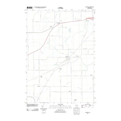
2010 Map of Oakfield
USGS Topo · Published 2010About this map
Oakfield serves as a central hub in this part of Fond du Lac County, where the village grid meets the winding course of Campground Creek. The surrounding agricultural landscape is defined by a dense network of country roads and family-named cemeteries that reflect the 19th-century settlement patterns of the region. Notable burial grounds such as Hawes Cemetery, Lamartine Cemetery, and Genesee Cemetery are scattered across the townships, providing valuable markers for genealogists and local historians.
Find a feature on this map
52 named features on this map. Tap any name to fly to it.
Don’t see what you’re looking for? This feature index may not catch every label — zoom into the map to look around manually.
Map Details
Editions of this 2010 Oakfield Map
This is the sole edition of this map. No revisions or reprints were ever made.
Other maps of this area

1910 · Fond du Lac
USGS Topo · 1:62,500

1955 · Waupun
USGS Topo · 1:62,500

1955 · Campbellsport
USGS Topo · 1:62,500

1955 · Fond Du Lac
USGS Topo · 1:62,500

1955 · Fond Du Lac
USGS Topo · 1:24,000

1956 · Rosendale
USGS Topo · 1:62,500

1957 · Madison
USGS Topo · 1:250,000

1960 · Madison
USGS Topo · 1:250,000
1974 · Byron
USGS Topo · 1:24,000
1974 · Lomira
USGS Topo · 1:24,000