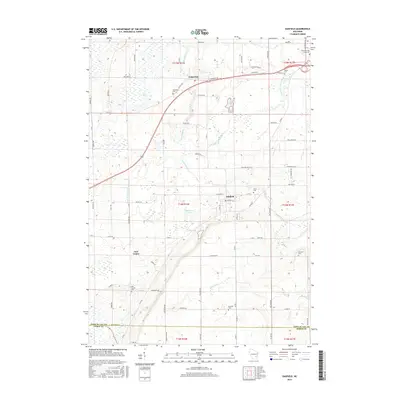
2015 Map of Oakfield
USGS Topo · Published 2015About this map
Lamartine sits at the junction of several regional routes in Fond du Lac County, serving as a northern anchor for this agricultural landscape. The village is surrounded by a network of rural roads such as Haberkorn Dr and Orchard Rd, while the Lamartine Cem provides a genealogical touchpoint for local families. To the south, the village of Oakfield is defined by its concentrated residential blocks and proximity to Avoca Cem.
Find a feature on this map
73 named features on this map. Tap any name to fly to it.
Don’t see what you’re looking for? This feature index may not catch every label — zoom into the map to look around manually.
Map Details
Editions of this 2015 Oakfield Map
This is the sole edition of this map. No revisions or reprints were ever made.
Other maps of this area

1910 · Fond du Lac
USGS Topo · 1:62,500

1955 · Waupun
USGS Topo · 1:62,500

1955 · Campbellsport
USGS Topo · 1:62,500

1955 · Fond Du Lac
USGS Topo · 1:62,500

1955 · Fond Du Lac
USGS Topo · 1:24,000

1956 · Rosendale
USGS Topo · 1:62,500

1957 · Madison
USGS Topo · 1:250,000

1960 · Madison
USGS Topo · 1:250,000
1974 · Byron
USGS Topo · 1:24,000
1974 · Lomira
USGS Topo · 1:24,000