2022 Map of Oakfield
USGS Topo · Published 2022About this map
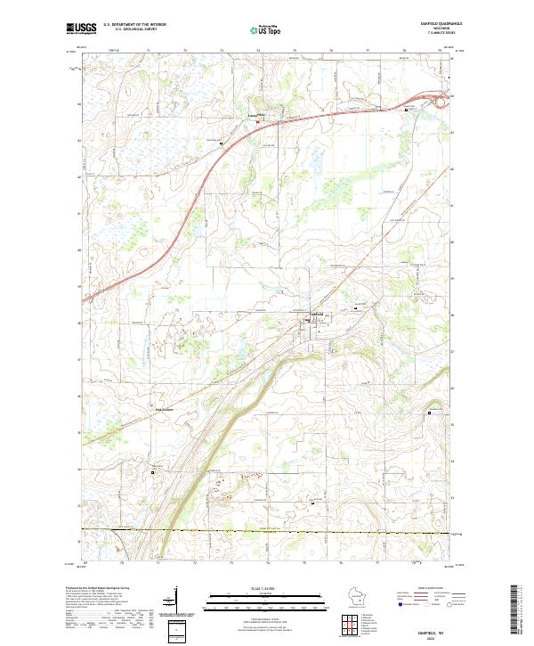
Oakfield serves as the central hub of this agricultural landscape in Fond du Lac County, where the intersection of Co Trunk Hwy B and the Wild Goose State Trl marks the village's modern footprint. The terrain is defined by the winding course of the E Br Fond Du Lac River and several smaller tributaries such as Campground Cr and Kummel Cr. For genealogists, the map provides a precise census of local burial grounds, including the Avoca Cem east of the village and the Oak Center Cem near the smaller settlement of Oak Center. In the northern section, the community of Lamartine sits along the riverbanks, anchored by the Lamartine Cem. This survey illustrates a well-established rural grid where family-named roads like Haberkorn Dr and Vielbig Rd connect small clusters of homes and farms to the larger state-managed trail systems.
Find a feature on this map
78 named features on this map. Tap any name to fly to it.
Don’t see what you’re looking for? This feature index may not catch every label — zoom into the map to look around manually.
Map Details
Editions of this 2022 Oakfield Map
This is the sole edition of this map. No revisions or reprints were ever made.