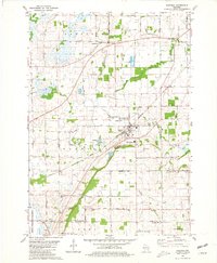
1980 Map of Oakfield
USGS Topo · Published 1981About this map
Oakfield serves as the industrial and social heart of this 1980 survey, defined by its position at the intersection of the Chicago and North Western railway and the East Branch Fond du Lac River. The landscape reveals a complex mix of agricultural land and resource extraction, with numerous quarries and a claypit supporting local industry near the Sewage Disposal and Industrial Waste Pond. Educational and community life is anchored by the Belle Reynolds Sch and the Avoca Cem.
Find a feature on this map
50 named features on this map. Tap any name to fly to it.
Don’t see what you’re looking for? This feature index may not catch every label — zoom into the map to look around manually.
Map Details
Editions of this 1980 Oakfield Map
This is the sole edition of this map. No revisions or reprints were ever made.
Other maps of this area

1910 · Fond du Lac
USGS Topo · 1:62,500

1955 · Waupun
USGS Topo · 1:62,500

1955 · Campbellsport
USGS Topo · 1:62,500

1955 · Fond Du Lac
USGS Topo · 1:62,500

1955 · Fond Du Lac
USGS Topo · 1:24,000

1956 · Rosendale
USGS Topo · 1:62,500

1957 · Madison
USGS Topo · 1:250,000

1960 · Madison
USGS Topo · 1:250,000
1974 · Byron
USGS Topo · 1:24,000
1974 · Lomira
USGS Topo · 1:24,000